
Monitoring the tailings dam failure of the Córrego do Feijão mine
On Friday, January 25th, the tailings dam to the Córrego do Feijão mine burst near Brumadinho, State of Minas Gerais, Brazil (the moment of failure was captured on video). Operated by Brazilian mining company Vale S.A., this incident recalls the collapse of Vale’s Samarco Mine in 2015 which unleashed 62 million cubic meters of toxic sludge downstream. As of Monday, the death toll reached 120, however, the full extent of damage is unknown. To monitor the impact, here is a Sentinel-2 scene of Córrego do Feijão from eighteen days before and seven days after the dam’s failure. As of February 2nd, approximately 2.85 km2 of sludge surrounds the region.
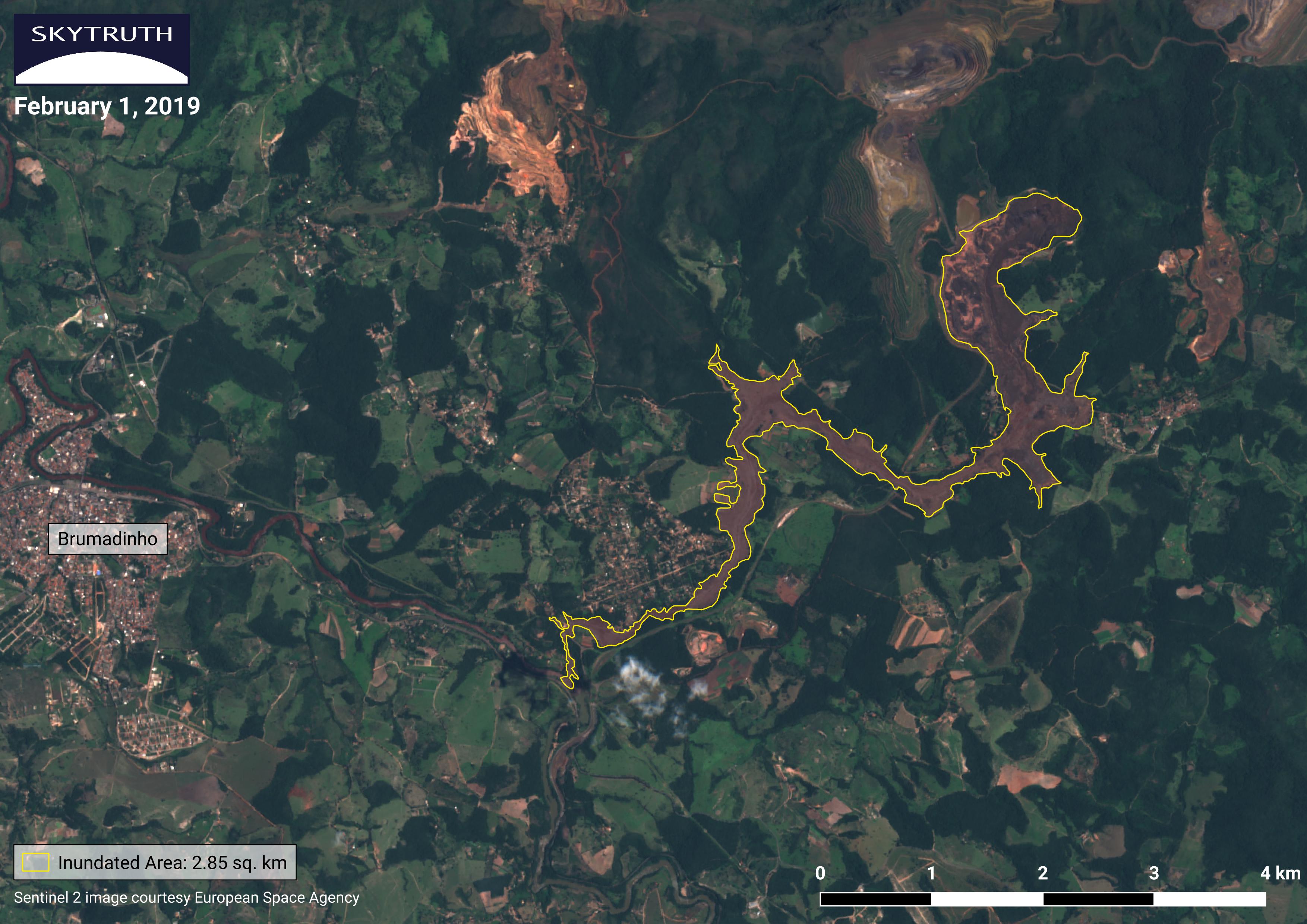
This slider, below, shows the area near the town of Brumadinho before and after the dam failure with the inundation highlighted in yellow, it can be accessed here.

